I have been thinking about World Atlases recently. Specifically I have considered what is their value, how they are produced and how good they are as a reference book.
Many of the major reference book publishing houses produce a World Atlas, and I've been fortunate in that I have worked on many of them. Some are wonderful reference books to possess and cherish. Others not. So this is my personal journey through the perils of producing a work of art and science. Something which should be expected to be authoritative, attractive and treasured.
In roughly chronological order, here are my impressions of the 10 World Atlases I have contributed to. What they were like to produce, what value they hold and some handy life tips!
Atlas 1
 The first World Atlas I made, exclusively working with 'conventional' techniques - type patching, scribing, peel-coats etc. Myself and another freelancer put in 50 hour weeks at a decent hourly rate, and on a Friday afternoon we were paid for that week in cash. Those were the days! I can't recall how accurate I thought the maps were at the time, but it was a nice enough book. The publisher is not renowned for its Atlases, and it did have a coffee-table feel to it. My only copy resides on my mother's book case.
Handy life tip: if paid in cash weekly, it is not necessary to spend all of it in 7 days.
Atlas 2
I didn't do a lot of work on this one, but helped out for a few weeks doing amends. Employing 'conventional' techniques again, the materials had been knocking around for years, being periodically dusted down, cobbled back together and spruced up for new editions. I felt more like a curator of antique manuscripts than a cartographer. The book had a long pedigree so carried some authority, but just felt a bit lightweight to me.
The offices were on an old airfield, above a hangar. This hangar was occupied by a Helicopter Pilot Training School. There were some hairy moments watching the trainees taking off for the first time through the office windows.
Handy life tip: allow for the lag in cyclic and collective pitch applications, to avoid overcontrolling.
Atlas 3

One day, a disciple asked Confucius: “If a king were to entrust you with a territory which you could govern according to your ideas, what would you do first?”
Confucius replied: “My first task would certainly be to rectify the names.”
The puzzled disciple asked: “Rectify the names?…Is this a joke?”
Confucius replied: “If the names are not correct, if they do not match realities, language has no object. If language is without an object, action becomes impossible - and therefore all human affairs disintegrate and their management becomes pointless and impossible. Hence, the very first task of a true statesman is to rectify the names.”
Not strictly a World Atlas, but a full colour 32-page Atlas section which formed part of an encyclopaedia. Almost all of maps were compiled on film and captured on the Mac. The project was notable in that I employed my teenage brother to compile some of the bases. His love of a smoothly functioning Rotring Isograph 1.8 endures to this day. In between marathon sessions playing Fish Tales on local Pinball machines, we got the maps finished and ran the films. Only then did the American publishers notice that many names were not spelt correctly, in their eyes. I had followed the conventions of the Permanent Committee on Geographical Names (PCGN), but the American's view was somewhat more parochial. So as a compromise we changed many major names so that they were more familiar to the users. So Beijing, Roma and Firenze became Peking, Rome and Florence.
Handy life tip: During Feeding Frenzy, you have 15 seconds to hit each of 4 purple fish. This will give you a total of 35M points
Handy life tip: During Feeding Frenzy, you have 15 seconds to hit each of 4 purple fish. This will give you a total of 35M points
Atlas 4
Ill-conceived from the start, and a logistic, technical and financial nightmare. The brief was to combine 2 existing Atlases (taking 50 pages from one and 200 from another), then to add in 50 pages of newly commissioned maps. Mix ingredients, stir well and simmer in the corner wondering why. One existing atlas was held in Freehand, the other in Illustrator. The two went together as neatly as a Scart lead fits into a USB port. So first we had to reconcile the detail so that it matched. Then devise a specification that would work on both software packages. The 3 component indexes then had to be merged, new index cuts made throughout, then duplicates removed and re-indexing thousands of names. Oh yes, then translate about 10,000 names as the atlas was not English. I was the Project Manager on this one, but it was a task way beyond me at that time - no way was I ready to control a $1M budget. The atlas is a bit of a mess frankly, as the two main contributing works were just too different content-wise. The procedure of combining hypsometric tints with hill shading never really worked, despite endless tweaking. Despite introducing text masking the tiny text is in places almost illegible against the background.
Handy life tip: Know your limits.
Atlas 5
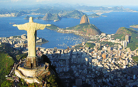 Quite a good product really, with a team at the Publishers who knew what they were doing. What holds this atlas back from being very good is having all text in black, so I think the overall appearance is rather dull. The job was to produce 3 foreign language editions with just a black plate replacement. I had the pleasure of entertaining an editor from Rio, who came to the UK for a few weeks to oversee the translations. I can still remember her name. I wonder where she is now?
Handy life tip: Don't let a Brazillian slip through your fingers.
Atlas 6
Oops! I did it again. This one should never have been taken on. The situation was that work was thin on the ground, so to avoid idle hands a low cost bid was submitted to land the job, contributing to a new edition. So I was on a downer from the start - knowing that there was no profit in it. The instructions were either not water-tight, or were mis-interpreted. I'm not too sure. As a result I missed my deadlines. The print date slipped. The revenue forecasts for the publisher fell due to subsequent income delays, and their share price then dropped.
It's a wonderful product, a benchmark of reference books, and I have a copy by my desk constantly. Backed up by a century or more of diligent work, and now maintained by use of a first class database. But sadly, I can claim no credit for it's success.
Handy life tip: Maintain focus. Even when your heart is not in it.
Atlas 7
Someone recently suggested to me that this atlas was a ground-breaking product, which broke the mould for the genre. I beg to differ. I wouldn't have one in my house.
As a supplier - providing services to complete a title without being directly associated with the publisher - you get a feel for the currency and accuracy of the data, and so bring your skills to bear to make the most of it. You eventually come to recognise when the data is not fit for purpose or has been shoddily prepared. And that was exactly the case here. By now I was used to assessing and manipulating data to deliver a good product, and the data supplied on this atlas was atrocious. The most basic level of data prep I was accustomed to had not been done. It was a serious mess.

Consider this atlas as you would a new dish prepared by a chef. He does not have all of the correct ingredients to prepare this dish, so he empties his cupboards, throws all of his available ingredients into a pot, and hopes that some essence of the dish will surface once it is cooked. As the Sous-Chef, I had to take this Dog's Dinner of a concoction and make it palatable. I'm not convinced that I achieved that objective. With no eggs in the larder, I had nothing to bind things together.
Once the first proofs had been delivered and edited, I got back the most appalling mark-ups I have ever seen, scrawled in big fat felt-tip pens. Not an inch of the proofs was not occupied by incomprehensible notes. Narrow your eyes and you'd think you were looking at a Pizza, with all of the trimmings. I took the unprecedented step of deciding that the materials were impossible to work with, and they were returned to the client as unusable.
If I have one major reservation about this atlas, it is that is was driven by design, rather than content.
Handy life tip: To maintain quality in mass production, measure and weigh every ingredient, every time. Consistency is the key to maintaining the quality of the food.
Atlas 8
I bounced back with this one. A pleasure to work on, with a fantastic States-side team up on their game. A wonderful re-branded product with 5 foreign language co-editions. I got my head around Quark Passport which worked really well to manipulate the various plates. The specification I was pretty proud of too, matching an existing product to a different clients' corporate style, which is very distinctive and one that any map geek would recognise instantly.
One big bonus was going to Spain to oversee my first Press Pass. I learned a lot there, and really enjoyed myself in a part of Spain I had not visited before.
 There were problems with the delivery of the books later on - thankfully nothing to do with me. It is a big book: 50cm high, 400 pages, 150,000 name index. Produced with a slip-case, this is a substantial (and heavy) product. The final deadlines were tight, but eventually we pressed the button, and said "GO" to the printers. Trucks were duly loaded and dispatched to all points North. Despite express instructions to the shippers not to load the pallets more than 2 high, they loaded them 3 high, and the pallets collapsed. The slipcases were crushed, the books damaged and there had to be a reprint. A beautiful book though - sadly I don't have a copy.
Handy life tip: Don't trust Truckers
Atlas 9
A multi-award winning atlas, and it's sort of OK. The original data didn't stand up to the scales of the pages required in many areas, but subsequent heavy editorial work sorted it out. Pushing 600 pages and 60cm tall, it's a monster. I'd love to have a copy, but it would not be my first point of call for a reference book. It still deserves the accolades though, a fine product.
Handy life tip: Big may not be better
Atlas 10

They just keep getting bigger. As the product is yet to be published, it's a bit too close to home to pass judgement on. At least in public!
So it's been quite a journey. And I'm still on the road. Talking of which, coming soon:
Get lost! Street Atlases to love and hate.
Why have a Road Atlas in your car? The Good, the Bad and the Ugly
Get lost! Street Atlases to love and hate.
Why have a Road Atlas in your car? The Good, the Bad and the Ugly


